
MCRT: Rutland


About MCRT Rutland
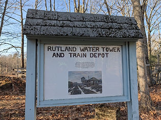
Rutland, incorporated in 1722, is a residential hill town at the geographic center of Massachusetts. At 1200 ft., Rutland has the highest elevation of any town east of the Berkshire Mountains and is known for clean air. Before colonists, Native occupants were the Nipmuc, and their settlement name was Naquag. Rutland has received many populations for care for two centuries. A Revolutionary War prison for Hessian soldiers was located at Barrack Hill Road. The Rutland State Sanatorium at Central Tree Road was the first in the Commonwealth. Until 1934 a Massachusetts Prison Camp near Whitehall Road operated with a successful dairy, egg and produce farm, and later added care for prisoners with tuberculosis. The large Veterans Administration Hospital at Maple Ave operated throughout the 1900s.
Rutland has a rich history of care giving and tourists enjoying the beautiful countryside.
Rutland Master Plan- Committee Comments
The MCRT in Rutland
In 1887 the Mass Central Railroad was completed with two stations in Rutland, and provided passenger service until the 1930s; freight service ended after the hurricane of 1938 destroyed several bridges and culverts in the area. Wachusett Greenways started development of the rail trail in Rutland in 2005, in partnership with the Town of Rutland, DCR DWSP, MassTrails and others.
Visiting the MCRT in Rutland
Access Points:
-
Muddy Pond parking lot on Rt 122 near the Rutland / Oakham town line – parking, short ramp to the MCRT
-
Large parking area on Route 122, 0.1-mile West of Fisherman’s road and 1 mile West of the Route 122 and Route 122A intersection. There is a year-round accessible portable restroom here.
-
Charnock Hill Road - MCRT intersection - Limited parking off the road on the east side, short ramp down to the MCRT on the northwest side
-
Miles Road - Parking for @ 10 cars with a kiosk, bench and granite monument pillar, on the MCRT route
-
102 Glenwood Road - Parking for 6-8 cars and an accessible portable restroom year-round.
Additional Resources
Connecting Trails:
-
Several trails in Rutland State Park
-
Midstate Trail, MA 92-mile hiking trail from Rhode Island to New Hampshire.
RideWithGPS Route (Road Route) - https://ridewithgps.com/routes/53440727
Trail Guide (West to East)
Mile
0.0 mi – Start at the Route 122, Muddy Pond parking lot on the north side. Follow a short ramp to intersect the MCRT, and travel East (to the right). Or you may already be on the MCRT traveling East from Oakham.
0.3 mi - The MCRT crosses from Oakham into Rutland at the Muddy Pond outlet, featuring Parker Brook entering a large wetland to the west and Muddy Pond to the East. There are several benches and overlooks on the rail trail here.
0.7 mi - Cross the unpaved Whitehall Road. (DCR / DWSP is managing the unique Pine Plain Barrens here to favor the native pitch pine.)

Snapping turtle laying eggs in the Pine barrens
1.3 mi - At the intersection of the MCRT and the Midstate Trail there is a granite pillar and a bench (Midstate Trail, MA 92 mile hiking trail from Rhode Island to New Hampshire.)
On the South side, a short connecting trail for MCRT and the Midstate Trail leads to the 30 car parking area on Route 122. There is a year-round accessible portable restroom here. (This lot is on the North side of Route 122, located 0.1 mile West of Fisherman’s road and 1 mile West of the Route 122 and Route 122A intersection.)

1.6 mi - Watch for a split rail fence on the North side where, there is an access to Rutland State Park with picnic pavilions, restrooms, swimming area, trails and entrance fees during the summer season. Ride this section high above the park with Long Pond overlooks.
Cross Rutland State Park entrance Road (Whitehall Road, asphalt paved).
2.3 mi - Continue East to cross Barrack Hill Road.
2.9 mi - Continue East to enter the tunnel under Charnock Hill Road – completed by Wachusett Greenways with support from the Town of Rutland, DCR, MA RTP and many volunteers. Note the extensive murals in the tunnel describing life in Rutland, created by artist Margaret McCandless in 2021. Photos of these wonderful murals are here. (There is a ramp here to Charnock Hill Road with limited parking off the road on the East side)
3.0 mi - Just beyond the tunnel is the Charnock Cut, the highest point on the MCRT and the deepest railroad cut. This 900-foot long granite cut is always cooler than the surrounding trail, and features ferns and moss in spring and summer, and icicles in winter and early spring.

MCRT over Long Pond.


3.7 mi - Continue along the beaver brook and over the Thayer Pond causeway where birds, benches, fish and moonlight views are plentiful.

Thayer Pond causeway
4.0 mi - Reach Miles Road parking for @10 cars with a kiosk, bench and granite monument pillar. Gap in the trail here. (Wachusett Greenways plans an off-road trail connection and welcome center at 21 Miles Road, currently the maintenance center.) Continue carefully up the hill on Miles Road and reenter the trail at a yellow bollard on the left.
4.3 mi - Cross under Pommogussett Road, Route 56 with a tunnel and murals depicting pond life. You can take a detour along an informal ramp up to the Route 56 sidewalk, and walk uphill to Rutland center – stores, restaurants and library within 0.6 miles.
4.4 mi - Travel along Moulton Pond with multiple granite benches and pond views, toward Glenwood Road.
4.6 mi - Site of the 1932 train crash, where two trains collided head-on.


4.7 mi - Spur trail on right to Watson Lane. There is access at the end of the cul-de-sac.
5.5 mi - Parking at @102 Glenwood Road is for 6-8 cars and an accessible portable restroom year-round. This begins a 2-mile gap in the trail. Option to travel on-road to reenter the MCRT at Wachusett Street, Rutland.
Turn right on Glenwood Road uphill, at the parking lot.
6.1 mi - Turn left on Wachusett St. (opposite Glenwood Community Center). Continue on Wachusett St.
7.4 mi - Reenter the MCRT on the right, just before you reach the blinking yellow light at Route 68. There is an ample parking lot at Wachusett Street with signage and a monument pillar.
Continue east on the MCRT from Wachusett St. on the old railroad bed parallel with Route 68, to the Rutland/Holden town line, about 1.1 miles, then turn left onto a short connection trail downhill to Rt 68. This is the East end of the Rutland section and a gap follows.
You may reverse, going 1.1 miles north on the MCRT to the Wachusett St. parking lot.
OR
Traveling East from Rutland, you may go on-road by bicycle or auto following Route 68 to its end in Holden. Turn left onto Route 122A, Main St., Holden. Turn left on Mount Pleasant Street; turn left on Princeton Street, bear right to stay on Princeton Street and ride along Maple Spring Pond; cross the active rail road tracks; continue uphill; pass a gate on the right at old Cobb Street, and continue a short distance to a gate and two-car parking on the right. Enter the MCRT here from Princeton Street to follow the next 9 mile contiguous section of the MCRT through Holden/West Boylston to Thomas Street, West Boylston.
Current MCRT Projects in Rutland
Wachusett Greenways will be starting a project to reduce the slope of the trail from 13% to under 5% at the Whitehall Road crossing.
For more information on the MCRT in Rutland

Wachusett Greenways is constructing and maintains the MCRT in Rutland, in partnership with the Town of Rutland, DCR DWSP, MassTrails and others. Wachusett Greenways stewards the thirty central miles of the MCRT including Rutland.

Volunteers are needed to help with trail maintenance and other activities – Join us.
Wachusett Greenways volunteers working on the Charnock Cut in Rutland, 2025
Explore Other Communities Along the MCRT
Geographical west to east
Northampton Hadley Amherst Belchertown Palmer Ware Hardwick New Braintree Barre Oakham Rutland Holden West Boylston Sterling Clinton Berlin Bolton Hudson Stow Sudbury Wayland Weston Waltham Belmont Somerville Cambridge Boston
For each MCRT town, we’ll connect you with maps, resources, suggested routes and trail status.